

FOSS4G is the acronym for Free and Open Source Software for Geospatial/ Geo Informatics, first coined in early 2004 by a research group working on I18N of GRASS and MapServer.
read moreThe term geoinformatics consists of two words, geo (Earth) and informatics (the study of information processing). Hence, geoinformatics can be understood as the union of Earth sciences and Informatics.
read more“No space should be left between the common man and space technology.”Shri Narendra Modi Ji
Hon. Prime Minister of India
“A map is the greatest of all epic poems. Its lines and colors show the realization of great dreams.”Gilbert H. Grosvenor
Editor of National Geographic
“The application of GIS is limited only by the imagination of those who use it ”Jack Dangermond
Esri
“GIS is the only technology that actually integrates many different subjects using geography as its common framework.”Jack Dangermond
Esri
“Mapping is fundamental to the process of lending order to the world.”Robert Rundstrum
1926
“GIS is the nervous system for the planet.”Jack Dangermond
Esri
“Open source is a development methodology; free software is a social movement”Richard Stallman
“The power of open source is the power of people. The people rule.”Philippe Kahn
“Certainly there's a phenomenon around open source. You know free software will be a vibrant area. There will be a lot of neat things that get done there.”Bill Gates

“I think fundamentally, open-source does tend to be more stable software. It's the right way to do things.”Linus Torvalds
Creator of the Linux kernel
Articles / Stories
News
Global Showcase
Videos


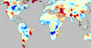
Groundwater accounts for 30% of Earth’s freshwater resources (Shiklomanov 1993).
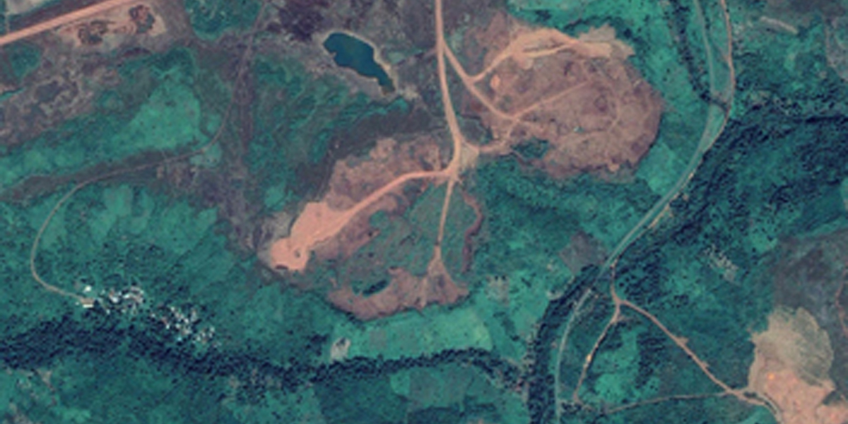
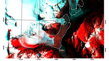
Satellite imagery can be used to identify and monitor environmental and
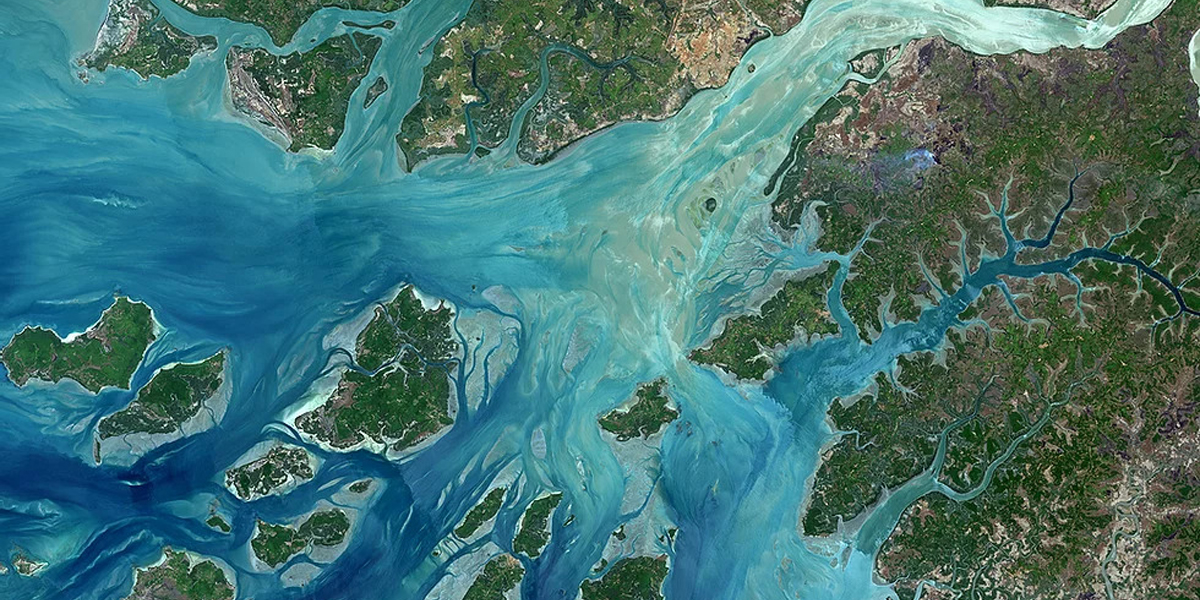
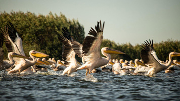
On 2 February 2020, we celebrate World Wetlands Day