Free and Open Source Software for Geoinformatics
National E-Governance Division
Ministry of Electronics and Information Technology
English
|
Hindi
English
|
Hindi
Home
(current)
Resource
(current)
Source Code
Documents
E-Books
Publications
Softwares
E-Learning
Community
(current)
Explore
(current)
Opportunities
(current)
Sectors
(current)
Agriculture
Disaster Management
Earth and Climate Studies
Water Resources
Urban & Infrastructure
Soils
Rural Development
Land Use/Land Cover
Geosciences
Forestry and Ecology
Projects
(current)
Community Projects
OSGeo Projects
Other Projects
Policies
(current)
National Geo Spatial Policy
Drone Policy
Login/Signup
Global showcase
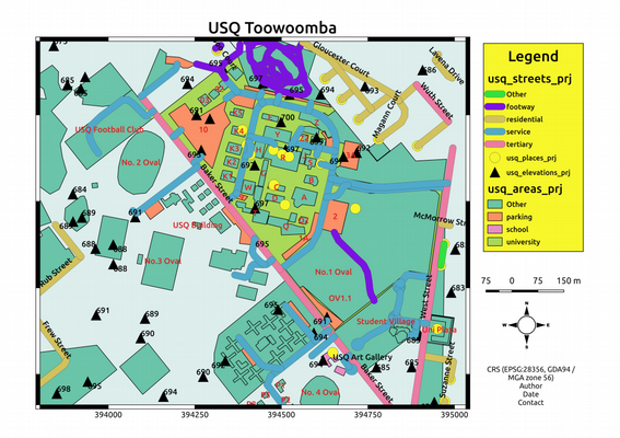
QGIS for distance learning and teaching GIS at Universities
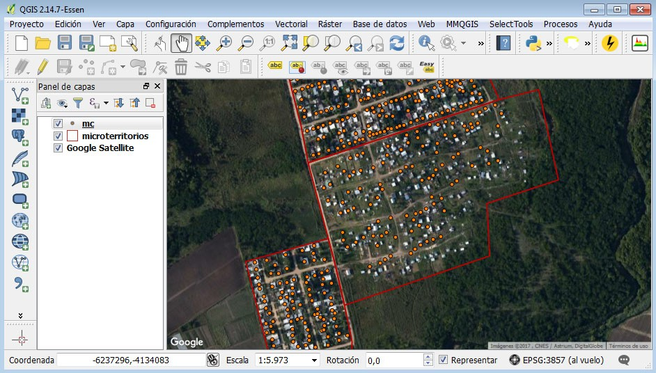
Use of QGIS at the Ministry of Social Development of Uruguay (MIDES)
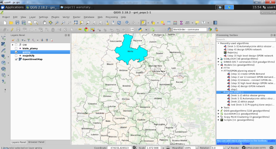
Using QGIS for FTTH/GPON network planning due to the implementation European Digital Agenda
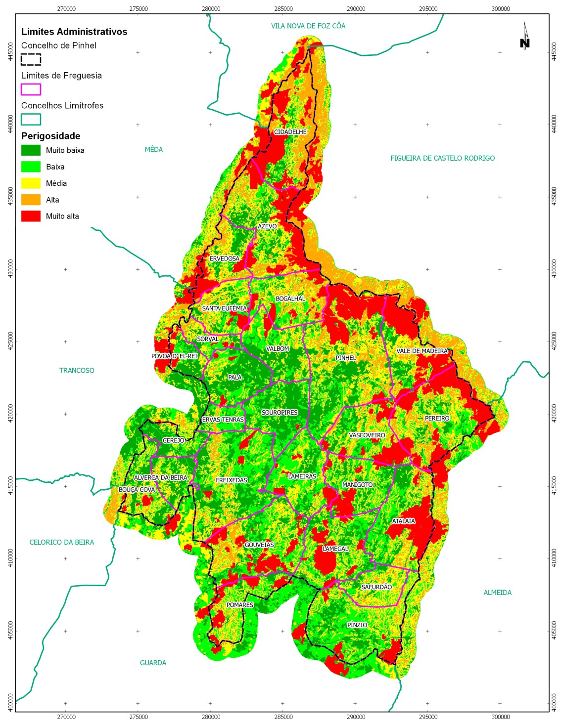
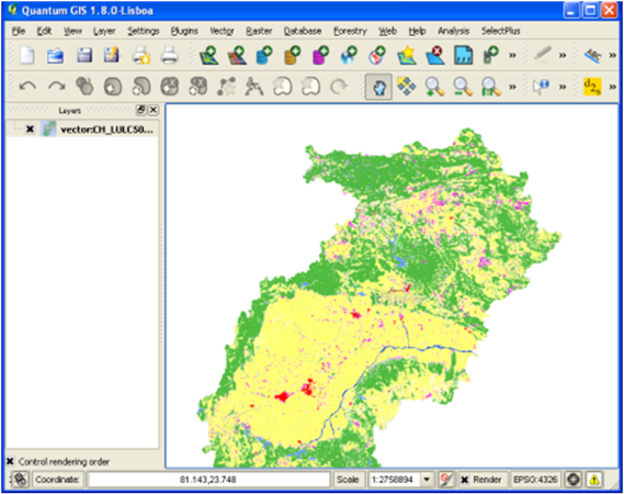
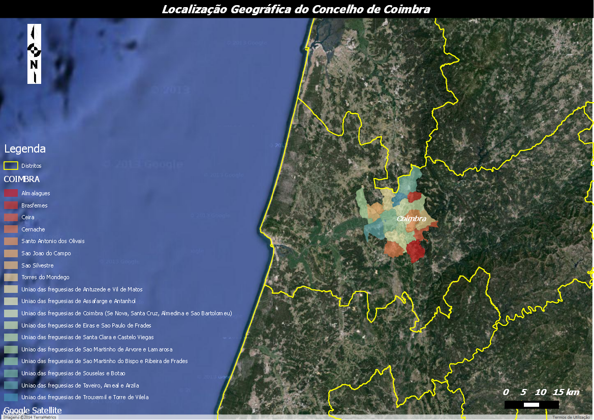
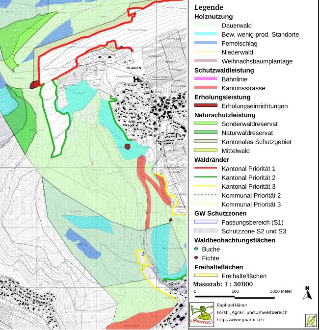
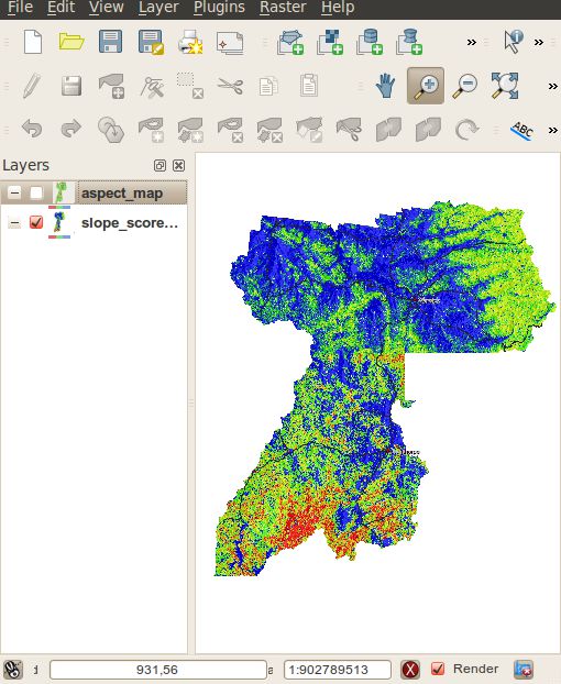
QGIS and Forest Fire Risk Mapping in Portugal
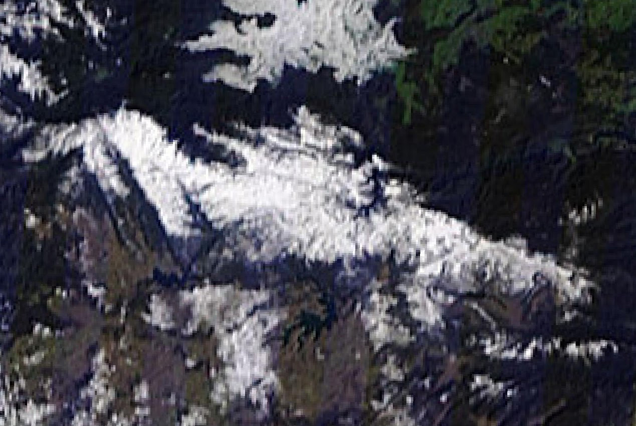
Using the processing toolbox to automate snow classification
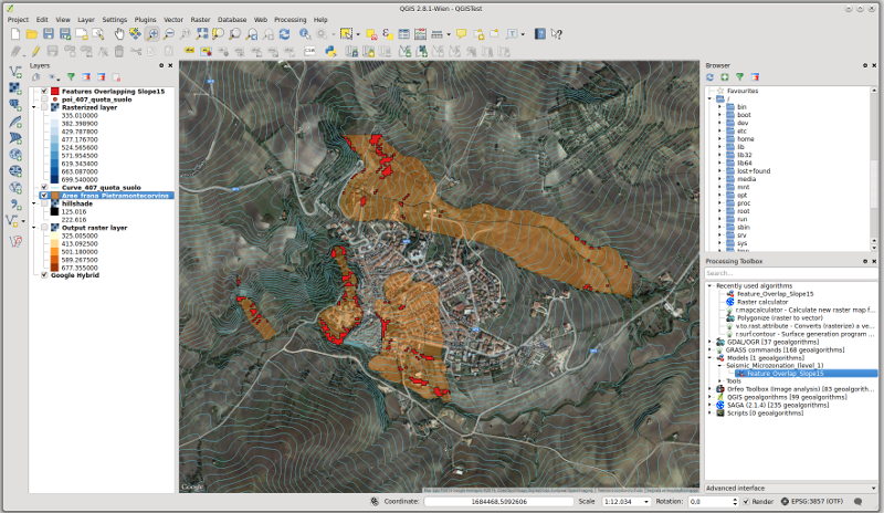
QGIS geoprocessing model to simplify first level seismic microzonation analysis
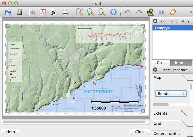
Creating the Fundy Footpath Trail Map with QGIS
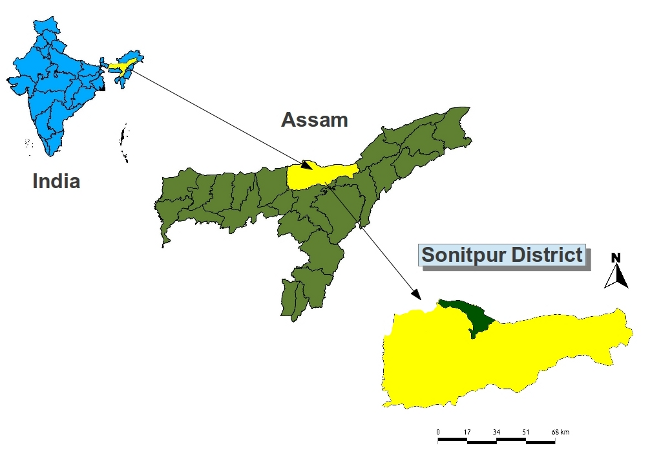
QGIS for monitoring tigers (using camera traps in Nameri Tiger Reserve, Assam, India Sonitpur District)
Use of python console to prepare offline map from WMS (tile downloader)
Using open source tools for characterization of a landscape. The LecosS plugin
QGIS — an interesting instrument for forestry planning concepts at local and regional level
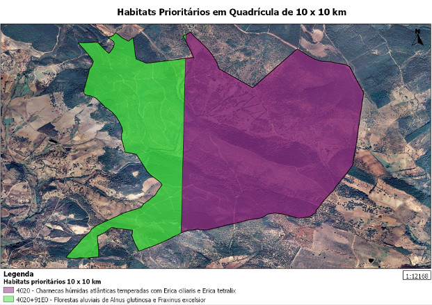
QGIS and GRASS in Biogeographical Research in the Iberian Peninsula
QGIS and GRASS in Local Government Bushfire Hazard Mapping
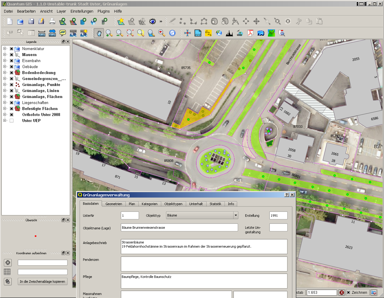
The use of QGIS in the Geodata Infrastructure of the City of Uster
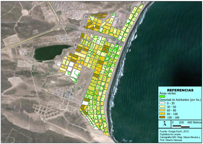
QGIS at high school — the urban green spaces in Rada Tilly coastal town, Chubut province, Argentina
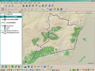
Using QGIS for wildlife training in Tanzania
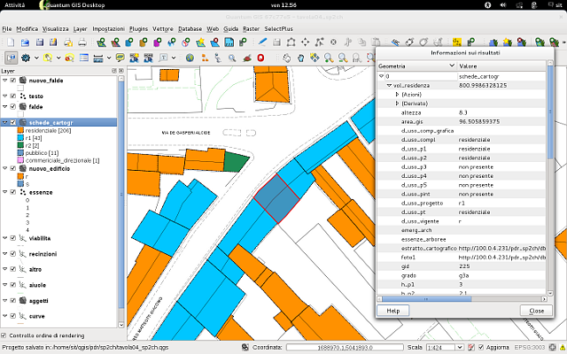
Using QGIS for urban planning in the municipality of Montecchio Maggiore, Vicenza, Italy
Using QGIS to Map Hotspot Areas for Biodiversity and Ecosystem Services (HABEaS)